Budget, Backpackers, Surfers, Beach Lovers, Naturalist, Hippie, Sun and Sand worshipers, Off the Beaten Path Paradise! Everyone is welcome at Zipolite!
Translate
A little about Playa Zipolite, The Beach of the Dead . . .
Playa Zipolite, Oaxaca, Southern Mexico, on the Pacific Ocean. A little bit about my favorite little get-away on this small world of ours.Zipolite, a sweaty 30-minute walk west from Puerto Angel, brings you to Playa Zipolite and another world. The feeling here is 1970's - Led Zep, Marley, and scruffy gringos.A long, long time ago, Zipolite beach was usually visited by the Zapotecans...who made it a magical place. They came to visit Zipolite to meditate, or just to rest.Recently, this beach has begun to receive day-trippers from Puerto Angel and Puerto Escondido, giving it a more TOURISTY feel than before.Most people come here for the novelty of the nude beach, yoga, turtles, seafood, surf, meditation, vegetarians, discos, party, to get burnt by the sun, or to see how long they can stretch their skinny budget.I post WWW Oaxaca, Mexico, Zipolite and areas nearby information. Also general budget, backpacker, surfer, off the beaten path, Mexico and beyond, information.REMEMBER: Everyone is welcome at Zipolite.ivan
Zipolite Blog Links
- Playa Zipolite
- Zipolite Entertainment, Party, Sports, Dance, Clubs, Music - - - Zipolite Entretenimiento, Fiesta, Deportes, Baile, Discotecas, Música
- Zipolite Food, Drink, Sunrise, Sunset - - - Zipolite Comida, Bebida, Amanecer, Atardecer
- Zipolite Nudist - - - Zipolite Nudista
- Zipolite ... Rentals, Camping, Hammocks, Apartments, House - - - Zipolite ... Alquileres, Camping, Hamacas, Apartamentos, Casa
- Zipolite Tours - - - Tours en Zipolite
- Zipolite Transportation and Rentals, Taxis, Bike, Moped, ATV - - - Zipolite Transporte y Renta, Taxis, Bicicleta, Ciclomotor, Cuatrimotos,
- Zipolite Yoga, Relax, Meditation, Temazcal - - - Zipolite Yoga, Relax, Meditación, Temazcal
- Budget Backpackers Off The Beaten Path - - - Mochileros económicos fuera del camino trillado
- Just For Fun ... by iVAn - - - Solo por diversión... de iVAn
- Near Zipolite - - - Cerca de Zipolite
- Travel Mexico - - - Viajes México
- ALL Playa Zipolite Blogspot Dot Com - - - TODO Playa Zipolite Blogspot Dot Com
Sunday, October 25, 2015
Monarch butterfly zone: speed limit 60 Speed zones a possibility in Coahuila as part of efforts to protect the butterfly
Monarch butterfly zone: speed limit 60
Speed zones a possibility in Coahuila as part of efforts to protect the butterfly
94 3
Mexico News Daily | Friday, October 23, 2015
Highway speed limits are usually reduced in populated areas for the safety of citizens. But a new speed zone could be coming soon to parts of Mexico, where the safety of monarch butterflies is the overarching concern.
That is one of many initiatives under way to protect a species whose numbers have been in decline as Mexico prepares to receive what is expected to be one of the largest monarch butterfly migrations in recent years.
For monarch enthusiasts, the states of Michoacán and México may be the most famous, because they host large overwintering grounds favored by the insects.
But on their way south the monarchs have to travel through a great deal of Mexican territory, part of which is the state of Coahuila. It is here that the National Protected Areas Commission (Conanp) has announced a novel project that seeks to have a positive impact the butterflies’ journey through the state.
Working with state environment and transportation authorities, Conanp plans to identify the general routes taken by the monarchs and install speed limit signs where these intersect with highways.
“The monarchs’ migration routes intersect with roads; in some cases they just fly over the vehicles, but in others they are affected by heavy traffic that may include trucks and buses. It also depends on weather conditions such as wind speed, and many factors,” said Conanp director Alejandro del Mazo.
“We may not know how many butterflies die on the roads, but we do notice that it is a large number thank to the remains left on the vehicles. This is a common occurrence on any road, but if the speed limit is lowered to 60 km/h, we give the monarchs enough time to be aware of the moving vehicles and avoid them,” added Environment Secretary Eglantina Canales.
The effort to provide safe passage to the monarchs encompasses 13 states where, in order to correctly assess and identify their feeding and resting grounds, over 10,000 people have been tasked with monitoring their travel routes.
“2015 is a very important year. We have combined efforts and achieved cooperation between the federal, state and municipal governments, and non-governmental and international organizations. We have over 10,000 people collaborating and following the migratory route,” said del Mazo.
These actions are part of a larger effort — by Mexico, the United States and Canada — to increase the monarch population to 225 million specimens by 2020.
This year’s migrating monarch butterflies have been sighted in Mexico since October 8, with the largest reported group this season sighted in Sabinas, Coahuila, on October 12.
Del Mazo expects a larger presence of monarchs in their hibernation sanctuaries this season, which are expected to extend over more than three hectares. Last season, in comparison, their presence was reported to cover a 1.3-hectare expanse of land.
The expected increase in monarch numbers could be a direct result of measures taken in past years by the United States, where milkweed — a food source for the butterflies — had been systematically eliminated with herbicides.
Since then, farmers, agribusiness companies, government institutions and universities have joined forces and created milkweed reserves, away from farmland crops but along the monarchs’ migratory routes.
The success of this measure may be short-lived, as reports of the wrong kind of milkweed being planted could represent yet another threat to the monarchs, increasing their odds of becoming infected with a crippling parasite.
Habitat loss in both the United States and Mexico has long been the main threat to the North American monarch population. During the 2013-2014 season, monarch presence in their hibernation sanctuaries extended to just over half a hectare, a stark decrease from the 1996-1997 season, the largest migration on record with 18.5 hectares.
- See more at: http://mexiconewsdaily.com/news/monarch-butterfly-zone-speed-limit-60/?utm_source=Mexico+News+Daily&utm_campaign=3c17170810-October+24&utm_medium=email&utm_term=0_f1536a3787-3c17170810-348153685#sthash.soSColhv.dpuf
Hurricane Patricia is strongest recorded 'Potentially catastrophic' Category 5 hurricane tracking towards Jalisco
News
Hurricane Patricia is strongest recorded
'Potentially catastrophic' Category 5 hurricane tracking towards Jalisco
Mexico News Daily | Friday, October 23, 2015
• Oct. 24, 1:40pm CDT: Only minor damage reported after Patricia
UPDATES TO THIS STORY:
• Oct. 24, 1:40pm CDT: Only minor damage reported after Patricia
• Oct. 23, 7:55pm CDT: Patricia touches land near Melaque, Jalisco
• Oct. 23, 4:25pm CDT: Hurricane Patricia's landfall between 5 and 6:00pm
Hurricane Patricia's forecast track as of early this morning. THE WEATHER CHANNEL - See more at: http://mexiconewsdaily.com/news/hurricane-patricia-is-strongest-recorded/?utm_source=Mexico+News+Daily&utm_campaign=3c17170810-October+24&utm_medium=email&utm_term=0_f1536a3787-3c17170810-348153685#sthash.y6EvYEEU.dpuf
Hurricane Patricia, which is now rated Category 5 and the strongest hurricane ever recorded in the Western Hemisphere, continues tracking towards the coast of Mexico with landfall forecast on the central coast of Jalisco between 4:00 and 6:00pm, where its effects could be catastrophic.
National Water Commission (Conagua) director Roberto Ramírez de la Parra confirmed that it is the most intense hurricane ever recorded in Mexico, warning coastal residents of the extreme danger it presents.
“A Category 5 hurricane can lift vehicles, houses that are not built with concrete and rebar and sweep people off their feet,” he said in a message broadcast on YouTube.
The hurricane warning area extends from Punta San Telmo in Michoacán to San Blas, Nayarit.
The U.S. National Hurricane Center, describing Patricia as “potentially catastrophic,” reported at 10:00am Central Daylight Time the storm is now moving northward at 17 km/h, with a turn to the north-northeast and a faster forward motion expected later today. It should make landfall within the warning area late this afternoon, forecasters said.
Its position was 200 kilometers southwest of Manzanillo and maximum sustained winds were 325 km/h.
The Weather Channel said this morning that the eye of Hurricane Patricia will move onshore in Jalisco, but the adjoining states of Colima and Nayarit will also feel its effects. In addition to “catastrophic winds” those will include “a formidable flood threat.”
The city of Manzanillo may experience destructive winds and is likely to see flooding rainfall, a dangerous storm surge and large waves breaking onshore, Weather Channel forecasters predicted.
Officials are warning residents within the hurricane warning area to remain indoors after 3:00pm this afternoon.
Over the next 48 hours, Patricia could deliver rain totaling 40% of that recorded annually. Conagua is forecasting as much as 250 millimeters in central and southern parts of Colima, in Jalisco and in the south of Michoacán.
Intense rains with accumulations reaching 75 to 150 millimeters are forecast for southern areas of Durango and Zacatecas, the south and east of Nayarit, much of Aguascalientes, the mountains and the south of Guerrero and the south and west of Guanajuato.
Waves up to 10 meters high are forecast for Jalisco.
National Civil Protection coordinator Luis Felipe Puente warned residents of homes with windows facing the ocean to stay away from them. He also warned against being inside a vehicle when the storm strikes.
Interior Secretary Miguel Angel Osorio Chong urged Jalisco residents, particularly those in Puerto Vallarta and the Bay of Banderas area, to take extreme caution and be aware of warnings and recommendations from state and federal authorities.
“No one knows what we are going be faced with; it’s becoming progressively more alarming,” he said, offering the warning that a cold front from the U.S. could increase the hurricane’s force.
Early this morning, evacuations began in zones of Puerto Vallarta deemed high risk. Officials were going door-to-door to advise citizens that they would have to take refuge in shelters. Businesses were being told close their doors as all commercial activities were to be suspended.
Emergency protocols have been enacted to put more than 10,000 police, soldiers and others on alert, including 2,500 employees of the Federal Electricity Commission.
An emergency has been declared in 10 municipalities in Colima, 34 in Jalisco and 11 in Nayarit where the number of people at risk has been estimated at 400,000. In those three states as well as Michoacán officials have readied 1,782 emergency shelters to accommodate 258,000 people.
The airports in Manzanillo and Puerto Vallarta have been closed, officials said.
Patricia’s strengthening from a Category 1 hurricane has been fast. Early yesterday it was rated Category 1 with winds of 135 km/h.
Only minor damage reported after Patricia Hurricane now a tropical depression near Zacatecas
Only minor damage reported after Patricia
Hurricane now a tropical depression near Zacatecas
Mexico News Daily | Saturday, October 24, 2015
The effects of Hurricane Patricia, the strongest
http://mexiconewsdaily.com/wp-content/uploads/2015/10/storm1-600x392.jpg
huricane in history, were felt across three Mexican states yesterday evening, leaving only minor damage and no loss of life, according to reports this morning.
The Category-5 storm made landfall at shortly after 6:00pm in the Bays of Tenacatita, Cuestecomate and Navidad in Jalisco, about 80 kilometers west-northwest of Manzanillo, Colima.
The eye of the storm battered the fishing villages and small towns of Melaque, El Estrecho and La Manzanilla with steady winds of 305 km/h and gusts up to 380.
“The waves were coming in to the hotel,” a night watchman at a hotel in Barra de Navidad told the Associated Press. Domingo Hernández said there were downed trees and utility poles everywhere in town.
Trees were knocked down in much of the region, and there was some flooding and mudslides, but little else had been reported in the way of damage as of noon today.
Strong winds and torrential rain continued in the area until about 9:00pm last night when the impact of the storm began to wane as it moved inland.
Nearly 10,000 people took refuge in emergency shelters while the same number of tourists were evacuated from Puerto Vallarta to Guadalajara.
The National Water Commission, Conagua, reported this morning that some areas recorded accumulated rainfall of nearly 400 millimeters over a 24-hour period ending at 3:00 this morning.
Nevado de Colima in Jalisco saw 383 millimeters, Sierra Manantlán, Colima, 297 and Lázaro Cárdenas, Michoacán, 261.
Sixteen hours after the monster hurricane struck the coast, it was downgraded by the U.S. National Hurricane Center (NHC) to a tropical depression as it passed 155 kilometers northeast of the city of Zacatecas, with winds of just 55 km/h.
But an NHC forecaster warned that tropical storm-force gusts were still possible near the center of the storm, especially at higher elevations as it moved across central and northeastern Mexico.
The National Meteorological Service forecast intense rain with accumulations reaching 75 to 150 millimeters in Coahuila, Nuevo León and Tamaulipas in a bulletin at 10:45am today.
Hey, Megan Alexis Kaelin (Megan Kaelin) just uploaded a new public set 4 Elwood. The tracks in the set: Mountain Range - A Silence Of Three Parts Listen to 4 Elwood From your friends at SoundCloud.
Hey, Megan Alexis Kaelin (Megan Kaelin) just uploaded a new public set 4 Elwood.
The tracks in the set:
From your friends at SoundCloud.
CBS RADIO MYSTERY THEATER -- "WHAT A CHANGE IN HILDA" (5-6-76) David Von Pein's Old-Time Radio Channel
CBS RADIO MYSTERY THEATER -- "WHAT A CHANGE IN HILDA" (5-6-76)
Bugs and Boars and Photos of Bolivia SEP 24
Bugs and Boars and Photos of Bolivia
Posted by TC
If you’ve read my blog before, then you probably know that my favorite website for information about living abroad is Transitions Abroad. Well I’m proud to say that my storyBugs and Boars in the Bolivian Jungle was awarded 3rd place in their 2015 Narrative Travel Contest. Please click the link for the story.
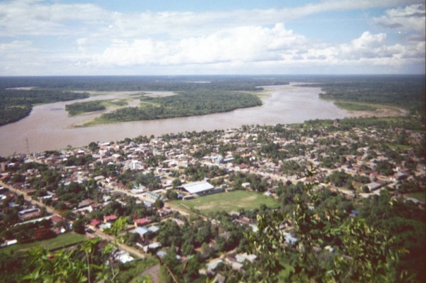
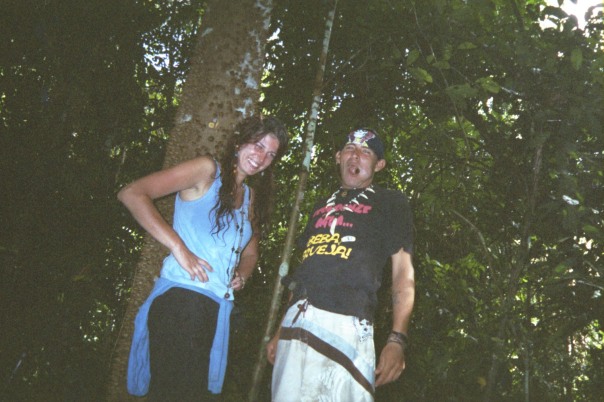
The story takes place half a day up the Beni River, a large tributary of the Amazon, from Rurrenabaque, a small town in the Bolivian jungle.
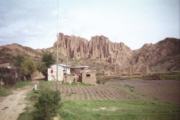
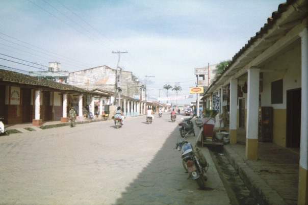
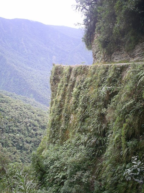
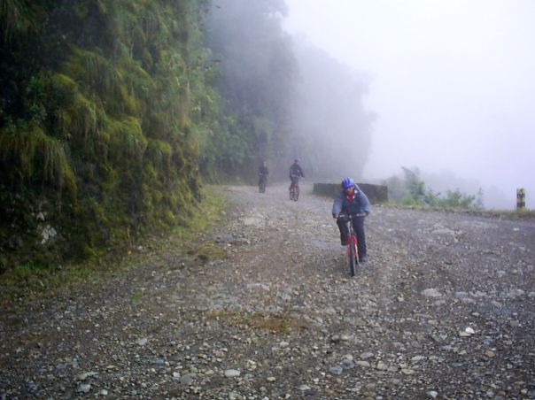
In total I spent about a month in Bolivia, mostly in La Paz:
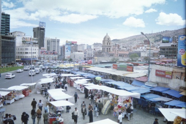
If you are wondering why the quality of these photos is so bad, it’s because I took them with a disposable camera. My digital camera – filled with a month of photos from Ecuador and Peru, including Machu Picchu – was stolen when I was poking around the market in this photo:
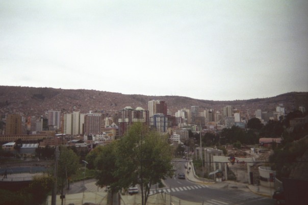
La Paz is built in a valley below the broad altiplano, a very high flat area. You can see the edge of it here:
There´s good hiking all around.
After La Paz I went to Rurrenabaque, where I went into the jungle, and after that I traveled across small towns in eastern Bolivia.
Back to La Paz – one of the tourist things to do, but really cool, is to ride a bicycle down the “World’s Most Dangerous Road,” which goes from high up in the mountains above La Paz all the way down to the jungle.
Thanks, and please click the link for my story Bugs and Boars in the Bolivian Jungle.
ZIPOLITE mounts TripAdvisor Image (Hotel Nude Zipolite, Zipolite): Zipolite INPONENTE - Snapshot View photos and videos (total 966) Location: Hotel Nude Zipolite ...
Hotel Nude Zipolite - fotografie: ZIPOLITE INPONENTE
Roca Blanca S/n | Puerto Angel, Zipolite, Mexiko
ZIPOLITE mounts
Image (Hotel Nude Zipolite, Zipolite): Zipolite INPONENTE - Snapshot View photos and videos (total 966) Location: Hotel Nude Zipolite ...

Tato fotografie místa Hotel Nude Zipolite byla poskytnuta s laskavým svolením webu TripAdvisor.
8 Hours Relaxing Nature Sounds-Sound of Water Relaxation-Meditation-Study-Sleep Relax-Waterfall johnnielawson
8 Hours Relaxing Nature Sounds-Sound of Water Relaxation-Meditation-Study-Sleep Relax-Waterfall
Weekly Photo Challenge – Careful in Zipolite, Mexico Posted on October 23, 2015
Weekly Photo Challenge – Careful in Zipolite, Mexico
A few years ago I holidayed in Zipolite, Mexico. This a beautiful beachside town (fortunately far south of Hurricane Patricia’s wrath this evening) that is famous for its forceful, unpredictable undertow that has claimed the lives of many locals and tourists. Some say the name actually translates to “beach of the dead” in the local dialect. There is a small, protected cove at one end of the beach where you can wade into the water or have a little float, but all along the main stretch of sand it’s imperative that you be careful and avoid going in the sea. What to do instead? Sunbathe in the nude, visit Shambala resort for yoga or healthy foods, or take a shared van to one of the nearby villages where the beaches are much safer.
Subscribe to:
Comments (Atom)

