Hurricane Roslyn makes landfall in western Mexico
After blossoming throughout the weekend into a strong Category 3 hurricane, Roslyn made landfall on Mexico Sunday morning, with the storm expected to bring heavy rain and damaging winds.
Roslyn evolved into a Category 4 storm on Saturday before being downgraded to Category 3 for its landfall at approximately 5:20 a.m. MDT Sunday, according to the National Hurricane Center. The storm landed in the west-central mainland of Mexico, near Santa Cruz in northern Nayarit. Maximum sustained winds at landfall were estimated to be 120 mph (195 km/h), and the storm was moving north-northeast at 16 mph.
As of 10 a.m. CDT, Roslyn was located about 125 miles (200 km) south of Durango, Mexico, with maximum sustained winds weakening to 90 mph (150 km/h), downgrading the storm to a Category 1 hurricane.
AccuWeather forecasters say Roslyn, the season's 17th named system, can take a similar path to Orlene from earlier in the month. The storm ended the brief break in tropical activity across the eastern Pacific Ocean, forming south of Mexico on Thursday.
Roslyn, which originated as Tropical Depression 19-E on Wednesday evening, is the first named storm to roam the East Pacific since Julia, which crossed over from the Atlantic basin. The last storm to actually form in the basin was Tropical Storm Paine. Paine developed in the open waters of the Pacific during the first week of October and was never a threat to land.
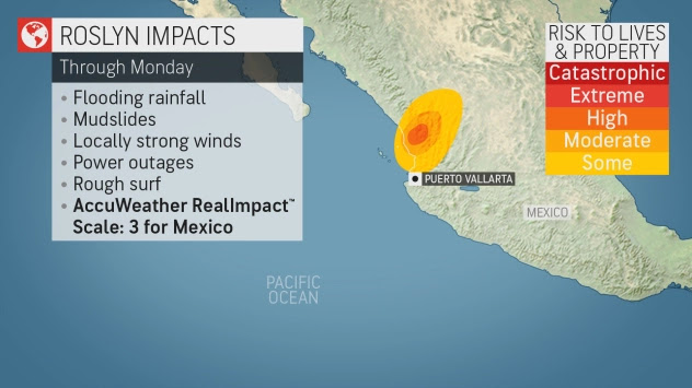
Unlike Paine, forecasters say Roslyn poses a significant risk to portions of western Mexico. AccuWeather meteorologists have rated Roslyn a 3 for Mexico on the AccuWeather RealImpact™ Scale for Hurricanes based on the expected impacts from wind, rain and storm surge flooding.


No comments:
Post a Comment
Thank you. Comments are welcome.
ivan